

HUBZone Map Overview
The HUBZone Map has been updated effective July 2023. Use this map to determine whether your principal office and employees are located in a HUBZone. Learn about the different types of HUBZone designations here: HUBZone Designations Fact Sheet.
Navigating the updated HUBZone map
SBA will not update Qualified Census Tracts and Qualified Non-Metropolitan Counties on the map again until July 2028. The five-year map cycle enables small businesses to plan and invest in their HUBZone communities without fear that their designation may change from one year to the next, thus providing stability for both the community and HUBZone businesses. However, some areas will cycle off before 2028. For example, HUBZones that are newly designated as Redesignated Areas will expire on July 1, 2026, and areas designated as Qualified Disaster Areas or Governor-designated Areas may expire throughout the year.
Certified HUBZone firms that are no longer eligible on July 1, 2023, due to the map change may continue to participate in the HUBZone program through their following annual recertification. Firms that have been awarded HUBZone contracts are generally considered HUBZone firms through the life of that contract.
For more information about the changes to the HUBZone map, see the HUBZone map update Guide for Small Businesses (ENGLISH | SPANISH )
SBA is committed to helping all current HUBZone firms during this transition. For additional questions, contact your local SBA District Office or email the HUBZone Help Desk.
A copy of the previous HUBZone map that was effective through June 30, 2023 is available here: Archive HUBZone Map (sba.gov).
Determining eligibility
You can use the Map to determine and document your eligibility for the Historically Underutilized Business Zones (HUBZone) Program run by the Small Business Administration (SBA). For a more detailed explanation of the HUBZone Program and the eligibility criteria, see the general HUBZone Program information section.
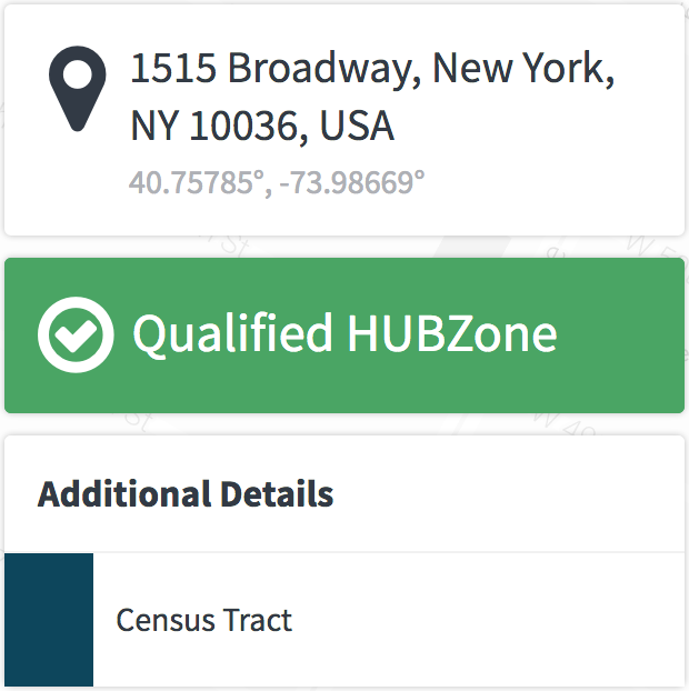
To determine the eligibility of a business or residence, follow these steps:
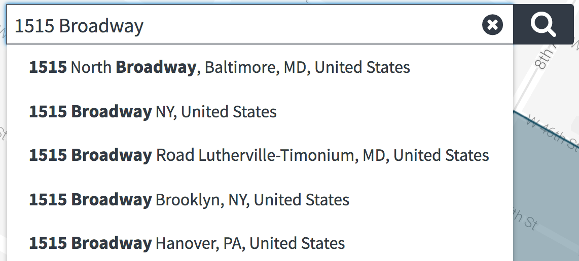
- Type the address into the search bar and click or tap search
- Check to make sure the search found the right address
- Read the qualification status
- Open a printable copy of the results
Understanding the Map
Search Bar
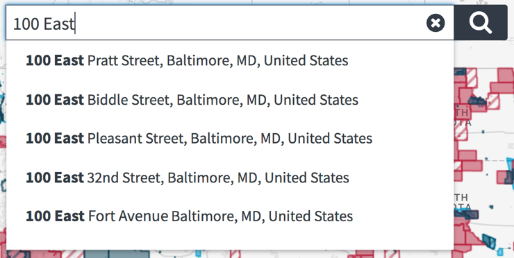
You can search for an address or a GPS coordinate on the Map using the search bar. When you start to type the address into the search bar, suggestions might appear. You can select any of the suggested addresses or continue entering the address. Press "Enter" or select the magnifying glass to search. You can clear the search field to enter a new address by selecting the "x" symbol.
If you would like to search for a specific GPS coordinate, use the format: 38.93655, -77.01993. Always list latitude then longitude. Do not use the degree "°" symbol. Make sure to use the "-" symbol to indicate negative GPS coordinates.
Legend
The Legend is a visual guide that helps you read the information shown on the map. The Map shows areas designated as HUBZones using colors and patterns. Each HUBZone or Expiring HUBZone has a different symbol in the Legend. You can view all county and tract boundaries by selecting them from the Census Boundaries section of the Legend.
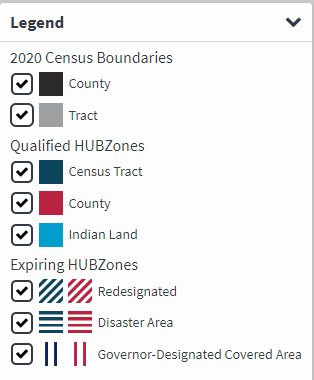
Census Tract
HUBZone Qualified Census Tracts designated by the Department of Housing and Urban Development (HUD) based on poverty and household income criteria.
County
HUBZone Qualified Counties located in non-metropolitan areas that meet at least one of the following socio-economic criteria: median household income (Census Bureau), unemployment rate (Bureau of Labor Statistics), or Difficult Development Area (Department of Housing and Urban Development).
Indian Land
HUBZone Qualified Indian Lands contained within the boundaries of an Indian Reservation, Indian Country, or any other specific definition that applies in the State of Oklahoma.
Redesignated Area
HUBZone Qualified Census Tracts and HUBZone Qualified Counties can lose their HUBZone qualification status. When that happens, the Census Tract or County will remain qualified for three years after the date of Redesignation. Redesignated Areas always show an expiration date next to their qualification status.
- Redesignated Census Tract
- Redesignated County
Disaster Area
HUBZone Qualified Disaster Areas are Census Tracts and Counties located in an area where a major disaster or catastrophic incident was declared by the President.
For a Census Tract or County to be designated as a Qualified Disaster Area, it must have become Redesignated within the period beginning 5 years before the major disaster or catastrophic incident declaration date.
A Disaster Area's qualification starts on the declaration date and ends on the date of the following five-year map update.
- Disaster Area Census Tract
- Disaster Area County
Governor-Designated Covered Area
Governor-Designated Areas are Census Tracts and Counties that have been requested by the state Governor to be designated as HUBZones and that have been approved by SBA. Eligible areas are located outside of urbanized areas (as defined by the Census), have a population of 50,000 or less and have an average unemployment rate 120 percent of the average unemployment rate for the U.S. or the state (whichever is lowest). For additional information, see What is the HUBZone Program's Governor-Designated Areas Initiative? | U.S. Small Business Administration
- Governor-Designated Tract
- Governor-Designated County
Using advanced Features
Base Map Toggle
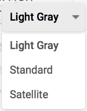
Use the base map toggle to change the base map. Each base map shows a different view of the information to help you navigate the map and find landmarks. The Standard base is the default map provided by Google including most streets, landmarks, and businesses. The Light Gray base map shows a less cluttered view of the surrounding landmarks and may help clarify differences in the HUBZone layers. The Satellite base map shows a satellite view of the terrain and if you zoom in far enough the map will switch to a 3D perspective view of buildings and landmarks.
Zoom

Use + and - buttons to zoom in and out on the map. Each time you click or tap the + or - button, the screen will magnify the scale of the map. On mobile devices you can also use pinch-to-zoom.
Street View

Use the pegman icon(left) to see a street level view of the map. You can click and drag the icon to the location you would like to see at street level. You can then use the arrows on your screen to move around at street level. To exit street view zoom out or click the back arrow in the top left under the search bar.
My Location
Giving permission to use your location

If you allow your web browser to use your current location, you will be able to determine if you are inside a Qualified HUBZone.
Selecting "Allow" or "Allow Location Access" will enable the location feature of your browser.
The map will not be able to get your current location if you selected "Don't Allow" or "Block" when using the map previously. In that case, you will need to change your browser settings for the HUBZone Map.
Errors in finding your location
If the HUBZone Map is unable to determine your location even when you grant permission, try reloading the page. If the problem persists, try clearing your browser settings or entering your address and searching in the map.
HUBZone Map Software Version
v4.0.2
Return to top